The semi-diurnal ups and downs of the tides cannot be recorded fast enough from satellite orbit. The sampling rate is too slow, which leads in signal theory to so-called aliasing. This means that a short-period signal is observed as a long-period onebecause the sampling rate is too slow. This is exactly what happens in satellite gravimetry. If the existing tidal models were perfect, this effect could be calculated and removed from the gravity field models of the respective satellite mission. Unfortunately, our tidal models are not perfect, so that any model errors will be interpreted, through aliasing, as long-period gravity field errors.
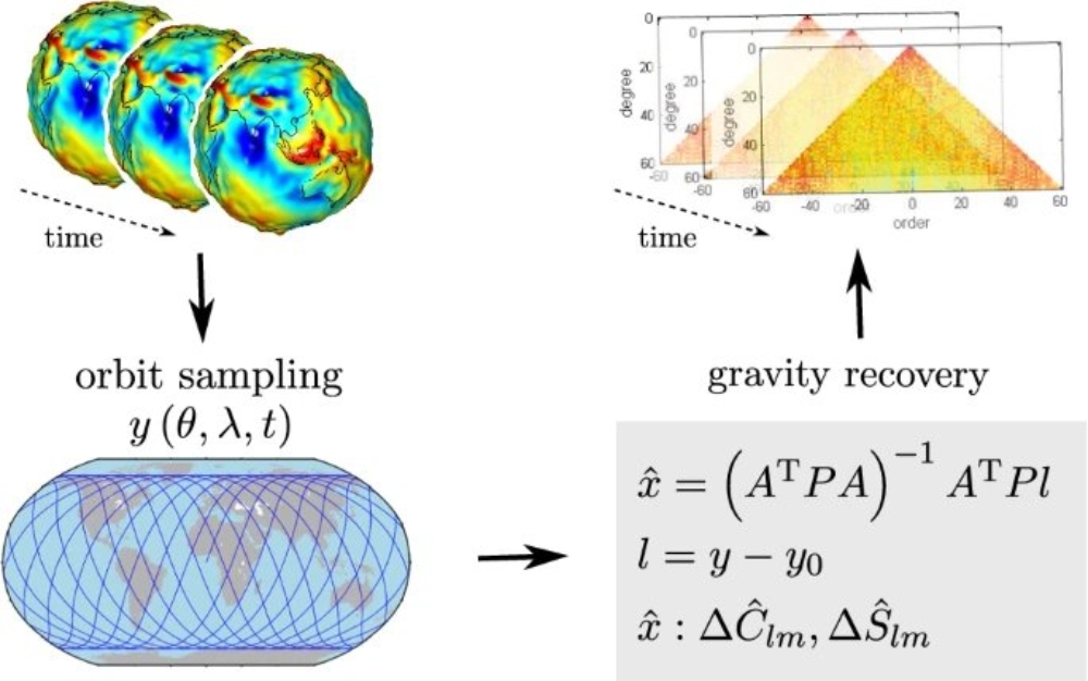
In this paper, the authors describe the aliasing mechanism in detail. They show how and at which periods the 8 most important tidal constituents map into the gravity field solutions. This spectral mapping is done both for real satellite gravimetry missions (CHAMP, GOCE, GRACE, GRACE-FO) and for potential future missions.