Coastal communities are highly exposed to ocean-related hazards, but often lack an accurate population and infrastructure database. On January 15, 2022 and for many days thereafter, the Kingdom of Tonga was cut off from the rest of the world by a destructive tsunami associated with the Hunga Tonga Hunga Ha’apai volcanic eruption. This situation was made worse by COVID-19-related lockdowns and no precise idea of the magnitude and pattern ofdestruction incurred.
The occurrence of such events in remote island communities highlights the need for (1) precisely knowing the distribution of buildings, and (2) evaluating what proportion of those would be vulnerable to a tsunami. A GIS-based dasymetric mapping method, previously tested in New Caledonia for assessing and calibrating population distribution at high resolution, is improved and implemented in less than a day to jointly map population clusters and critical elevation contours based on runup scenarios, and is tested against destruction patterns independently recorded in Tonga after the two recent tsunamis of 2009 and 2022 (Figure 1). This project is the result of an active contribution with Jean Roger (GNS Science), Yanni Gunnell (University Lumière Lyon 2), and Salman Ashraf (GNS Science).
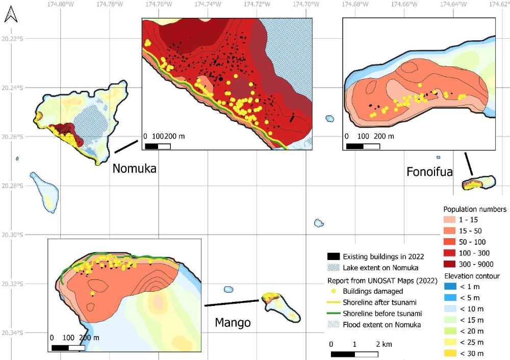
Results show that 62 % of the population of Tonga lives in well-defined clusters between sea level and the 15 m elevation contour. The patterns of vulnerability thus obtained for each island of the archipelago allow exposure and potential for cumulative damage to be ranked as a function of tsunami magnitude and source area. By relying on low-cost tools and incomplete datasets for rapid implementation in the context of natural disasters, this approach works for all types of natural hazards, is easily transferable to other insular settings, can assist in guiding emergency rescue targets, and can help to elaborate future land-use planning priorities for disaster risk reduction purposes.