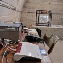
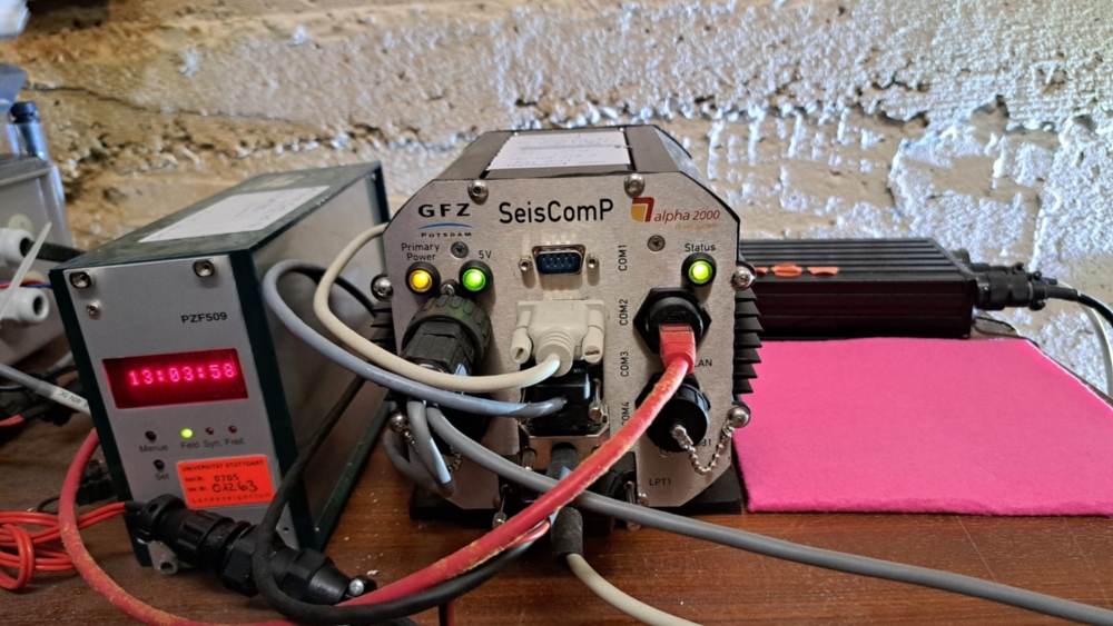
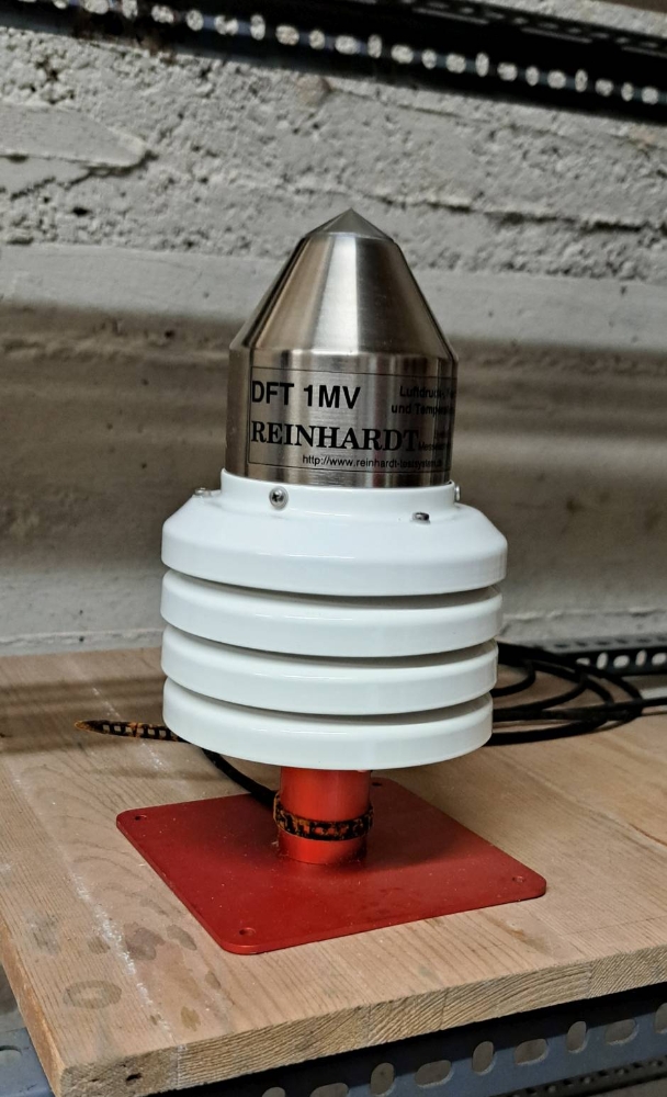
Die seismische Breitbandstation in Stuttgart (STU) ist in die Netze GEOFON (GeoForschungsNetz) und GRSN (German Regional Seismic Network) integriert. Die Installation besteht aus einem Wielandt/Streckeisen Seismometer STS-2, einer Reinhard DFT 1MV Wetterstation, einer Meinberg PZF509 DCF77 - Uhr, einem EarthData PS2400 24Bit Digitiser und einer SeisComBox mit OpenWRT und SeisComP (Seismological Communication Processor) als Datenerfassungs-, Verarbeitungs- und Verteilungssystem.  LHZ Tagesplot der GEOFON Station STU [pdf] / mehr bei GEOFON & GRSN

Allgemeine Informationen
Standort
Koordinaten der Station
| Länge: | 48° 46 ' 14.41'' |
| Breite: | 9° 11' 36.52'' |
| Höhe: | 360 meters |
Standortbeschreibung
Die Station liegt am südöstlichen Rand des Tals, in dem Stuttgart liegt. In der Nähe befinden sich Verwaltungs- und Wohngebäude. Eine Straßenbahnlinie ist etwa 100 Meter entfernt. Die Hauptlärmquelle für die horizontalen Komponenten sind fahrende oder einparkende Autos auf einer Straße fast direkt über dem Seismometergewölbe. Hier ein Blick auf die Umgebungskarte.
Weitere interessante Infos zum Standort gibt es bei Schutzbauten Stuttgart e.V. [DE].

Datenabruf von STU
Zugang zum Data Management Center
- Das
 Seismologische Observatoium Erlangen/Gräfenberg (SZGRF) stellt kontinuierliche Daten über AutoDRM (autodrm@szgrf.bgr.de) oder WWW-Abfrage zur Verfügung.
 - Das GEOFON Datenzentrum bietet Zugang über Live Seismogram und GEOFON SeedLink Monitor
- Seit kurzem hat auch das ORFEUS-Datenzentrum damit begonnen, STU Daten zu verteilen und zu archivieren.
Geologic situation
Piers are of concrete on hard triassic marls (middle Keuper km4). They are situated in an old air-raid shelter system about 20 meters below the local ground level. Have a look at the geologic map or a geologic cross section.
Seismometer
The station is equipped with a Wielandt/Streckeisen STS-2 broad-band seismometer. It represents a high-pass filter for the ground velocity with an eigenperiod of 120.7 seconds and 0.719 of critical damping. The transducer constant is 1500 Vs/m.
Data Acquisition System
The data acquisition system consists of an Earthdata PS24-6, controlling the analog to digital conversion and sampling. After sampling and filtering/decimating data is transferred to SeisComBox with OpenWRT(Linux) running a SeisComP software (Seismological Communication Processor) as data acquisition, processing and distribution system.
Available Data Streams
The three seismometer components (Z,N,E) are sampled with 100 samples per second (SP) and 24 bit resolution and are provided as short period channels. From these four more data streams are derived by low pass filtering and decimation:
broad-band (VBB, 20 samples per second), long-period (LP, 1s interval), very-long-period (VLP, 10s interval) and ultra-long-period (ULP, 100s interval).

monthly plot of Reinhard DFT data of Station STU
|
1893 |
Karl Mack und August v. Schmidt errichten auf Empfehlung der seismologischen Kommission von Württemberg eine seismische Station in Hohenheim bei Stuttgart. Es wurden nur die maximalen Amplituden des seismischen Signals aufgezeichnet. |
|
1895 |
Das Erdbeben vom 14. April in Ljubljana wurde erfolgreich aufgezeichnet. |
|
1897 |
Das Statistische Landesamt Württemberg übernimmt den Betrieb der Seismometerstation in Hohenheim. |
|
1903 |
Überregionale Bedeutung erlangt die Station in Hohenheim durch die Aufnahme in die Internationale Seismologische Vereinigung in Straßburg. |
|
1905 |
In Hohenheim wird ein neues Gebäude errichtet und mit mechanischen Seismographen instrumentell ausgestattet. Ihre Aufzeichnungen werden in unserem Archiv aufbewahrt. |
|
1925 |
Karl Mack geht in den Ruhestand. Die Station wird Teil der metereologischen Abteilung des Statistischen Landesamtes Württemberg. Der Name wird in Metereologische und Geophysikalische Abteilung geändert. Wilhelm Hiller übernimmt die Betreuung der Erdbebenstation. |
|
1929 |
Einrichtung der Seismometerstation Stuttgart in der "Villa Reitzenstein" (heute Staatsministerium). |
|
1934 |
Die Metereologie wird vom Statistischen Amt zum Reichswetterdienst verlegt. Die geophysikalische Abteilung wird weiterhin von Wilhelm Hiller geleitet. Der Standort Hohenheim wird aufgegeben. |
|
1961 |
In Stuttgart wird eine WWSSN-Station (World Wide Network of Standard Seismographs) eingerichtet. |
|
1962 |
Die Technische Hochschule Stuttgart erhält eine Professur für Geophysik. W. Hiller wird Professor und bleibt in Personalunion Leiter der geophysikalischen Abteilung im Statistischen Amt. Das Institut zieht in die Richard-Wagner-Str. um. 4 |
|
1968 |
Wilhelm Hiller wird emeritiert. |
|
1969 |
Klaus Strobach wird Nachfolger von W. Hiller am Institut für Geophysik der Universität Stuttgart. Das Statistische Amt übergibt die geophysikalische Abteilung an die Universität. |
|
1988 |
KKlaus Strobach wird emeritiert. Sein Nachfolger ist Erhard Wielandt. |
|
1997 |
Die Station wird über das Internet zugänglich. |
Schauen Sie sich einige Bilder von historischen Instrumenten in Stuttgart an.
|
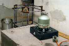
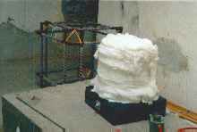
Ein STS-2 mit dem Einstellpol nach Osten. Das Seismometer steht auf einem schwarzen Grabstein (Gabbro), der Teil der Abschirmung gegen Luftdruckschwankungen ist. |
|
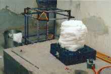
Das Seismometer ist mit Watte umwickelt, um Luftkonvektion zu verhindern und so die thermische Abschirmung zu verbesser |
|
Der obere Teil der Luftdruckabschirmung besteht aus einem großen Kochtopf, der das Seismometer abdeckt. Der Topf ist mit mehreren Schrauben fest mit dem Grabstein verbunden. Zwischen beiden Teilen befindet sich eine Dichtung. |
|
Auch hier ist etwas Watte eingewickelt. |
|
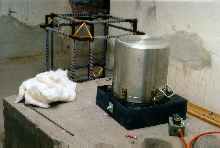
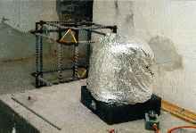
Schließlich verwenden wir ein strahlungsreflektierendes Rettungsfolie, um die thermische Abschirmung zu beenden. |
|
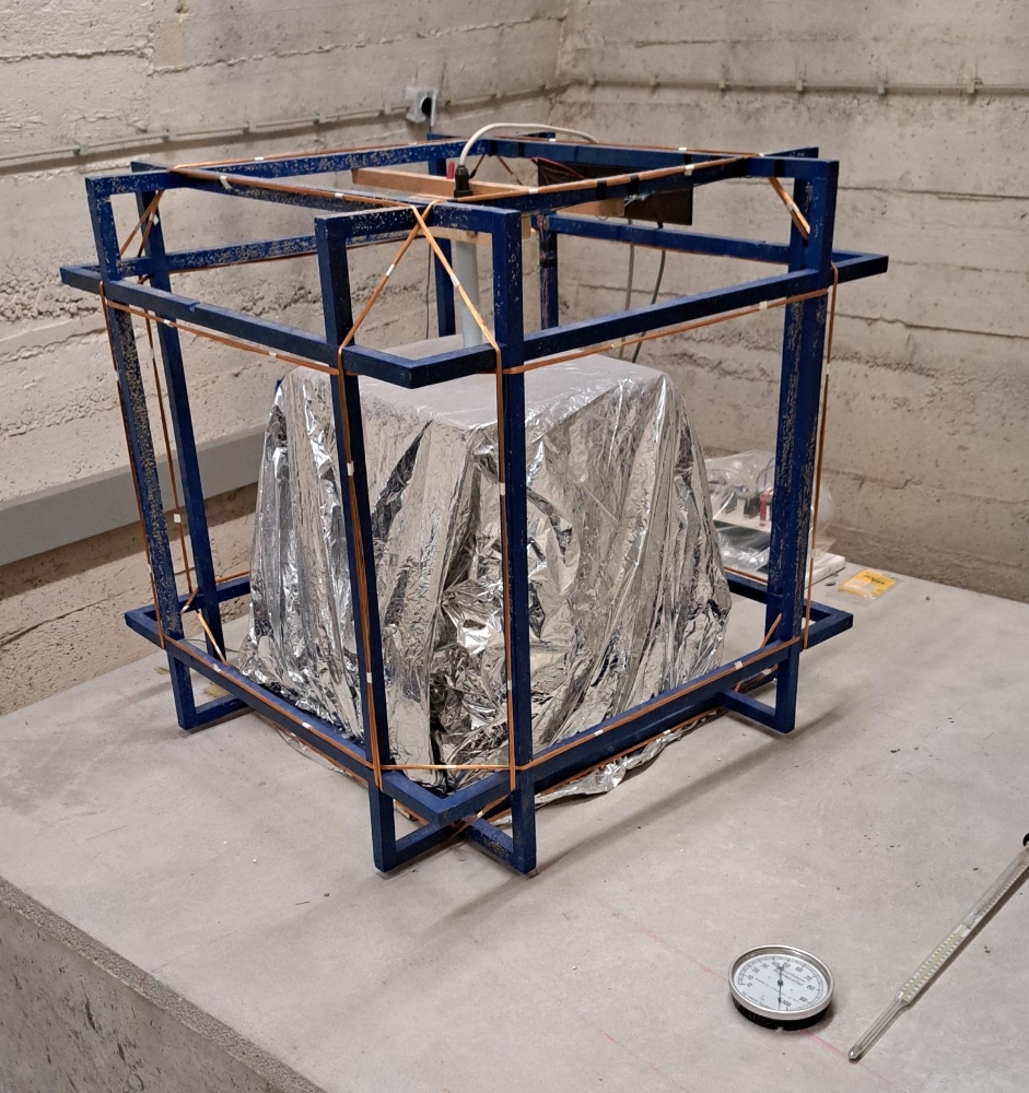
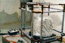
Da sich die Station innerhalb der Stadt befindet, haben wir Auswirkungen von Strömen erfahren, die durch die öffentliche Straßenbahn in die Erde induziert werden. Diese Ströme erzeugen Magnetfelder, die mit dem Seismometer interagieren. Um das Seismometer vor diesen Feldern abzuschirmen, haben wir einen Würfel mit drei Helmholtz-Spulenpaaren installiert. Sie werden von einem elektronischen Rückkopplungssystem mit einem Dreikomponenten-Flux-Gate als Sensor gesteuert. Das Flux-Gate fehlt auf diesem Bild, ist aber oben auf dem Seismometer der Station STU zu sehen. |
|
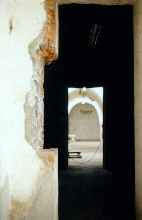
Der Helmholtz-Würfel ist kein sehr handliches Teil. Er war sogar zu groß für eine der Türen. |
Rudolf Widmer-Schnidrig
Ph.D.Scientific Employee
- Profile page
- +49 7836 2151
- Write e-mail
- My main research interest is in low-frequency seismology: observing the elasto-gravitational free oscillations of the Earth to infer mantle and core structure. Since 2000 I work at the Black Forest Observatory (BFO) where we operate sensors to observe the entire geodynamic spectrum in gravity, strain and tilt. At BFO we also tested seismometers for the InSight mission to Mars and I am now involved in the analysis of these data to study the martian interior. Most recently I have also searched for the signature of compact dark matter objects (CDOs) in terrestrial gravimeter data.