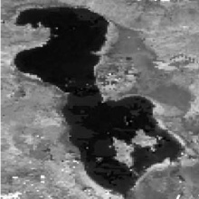
Urmia, once the largest permanent hypersaline lake in the world, has been shrinking at an alarming rate during the last decade. It is the biggest inland water body in Iran and was announced as a Wetland of International Importance by Ramsar Convention in 1971 and determined as a UNESCO Biosphere Reserve in 1976. The drying up of the lake has been occurring due to a chain of reasons. The negative trend in precipitation accompanies the increase in air temperature has been mentioned as the two main climatic factors for the observed depletion of the lake. Moreover, on one hand, the lands required irrigation has expanded dramatically during the last two decades which increased the water demand for agricultural purpose. Meanwhile, the irrigation system has been running with low efficiency and flow regulation using constructing dams indirectly lessened inflow to the lake by accelerating the expansion of the irrigating areas.
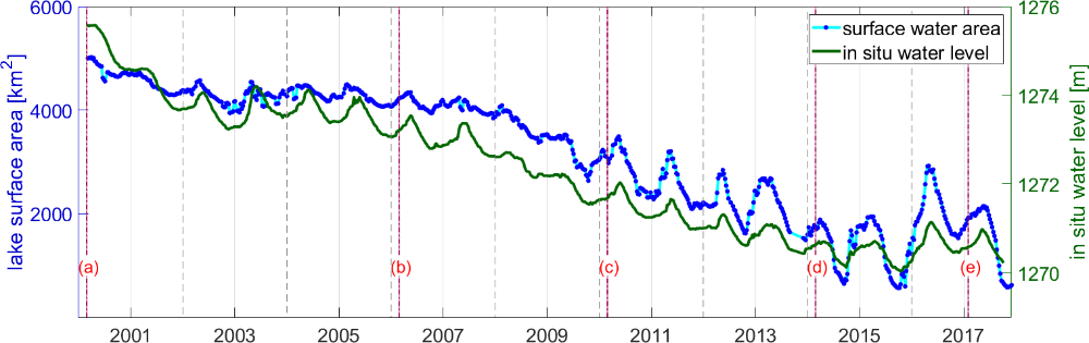
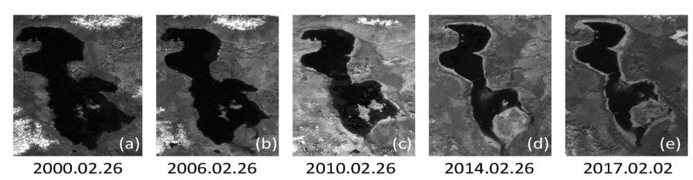
In this project, we monitor the state of the lake using spaceborne approach. We utilize multi-mission satellite altimetry to extract water level, satellite imagery to estimate the surface water extent, and water storage change from the Gravity Recovery and Climate Experiment (GRACE). By combining water level from altimetry, surface water extent from satellite imagery and local bathymetry, we ascertain the changes in lake volume. Moreover, we investigate the role of climate and human activities, including the “Urmia Lake Restoration Program”, mainly after 2014. We also employ augmented data of the lake and its basin such as in situ data of the inflow to the lake and the groundwater, evaporation of the lake, precipitation, and evapotranspiration of the basin.

Peyman Saemian
Dr.-Ing.Scientific Employee